Semester 1
Database backend for a WebGIS
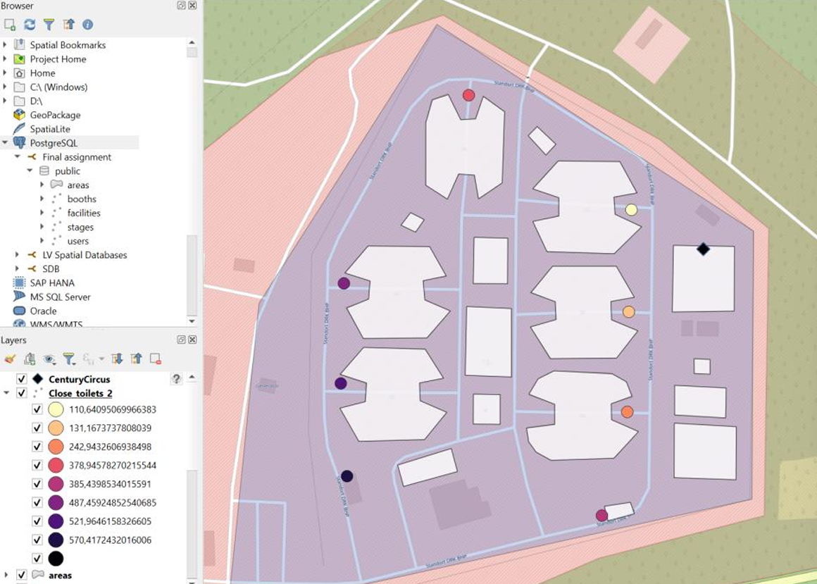
Spatial Databases
As my final project, I created a database with PostgreSQL for the NatureOne festival, which can serve as a backend for a WebGIS. In this context, in addition to creating a database in the third normal form with views and indexes, queries were defined that show the potential of the database. The complete source code can be found here.
Object-based & knowledge-based classification
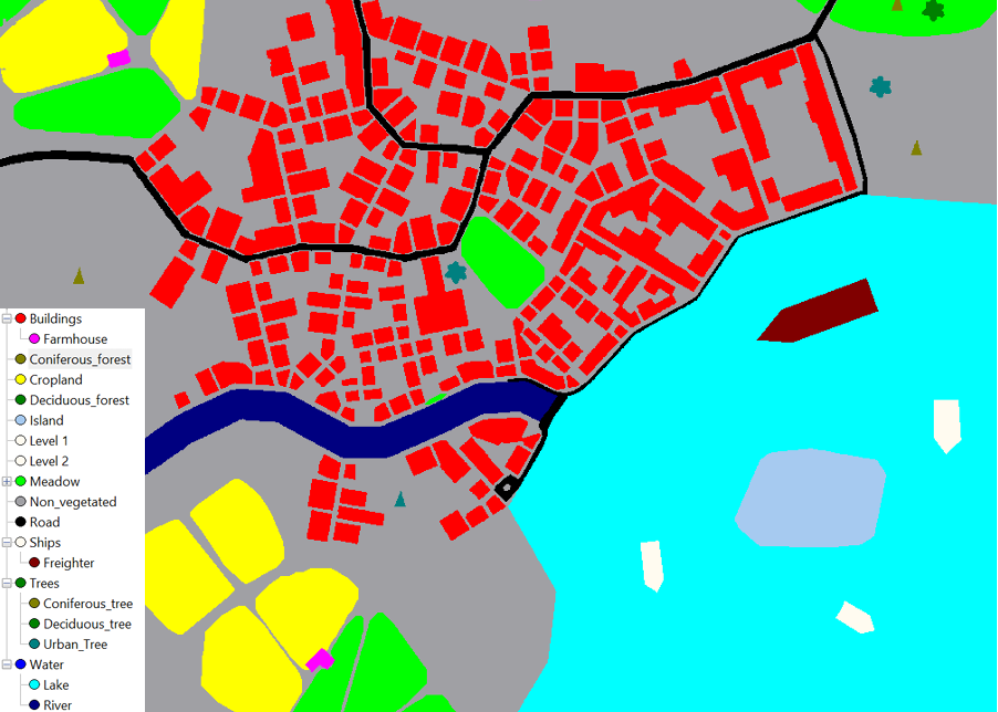
Object-based Image Analysis
For the final examination, an object-based classification on an artifical landscape image was carried out using eCognition. Based on a first classification, a rule-based classification was conducted to differentiate the initial classes using expert knowledge.
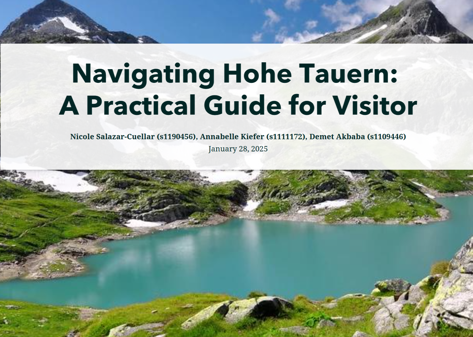
Navigating Hohe Tauern: A Practical Guide for Visitors
Geovisualization & Advanced Cartography
As part of a group project, we designed an ArcGIS StoryMap entitled Navigating Hohe Tauern: A Practical Guide for Visitors. Our task was also to create a second StoryMap focusing on the development process by defining precise objectives and a target group which can be found here.
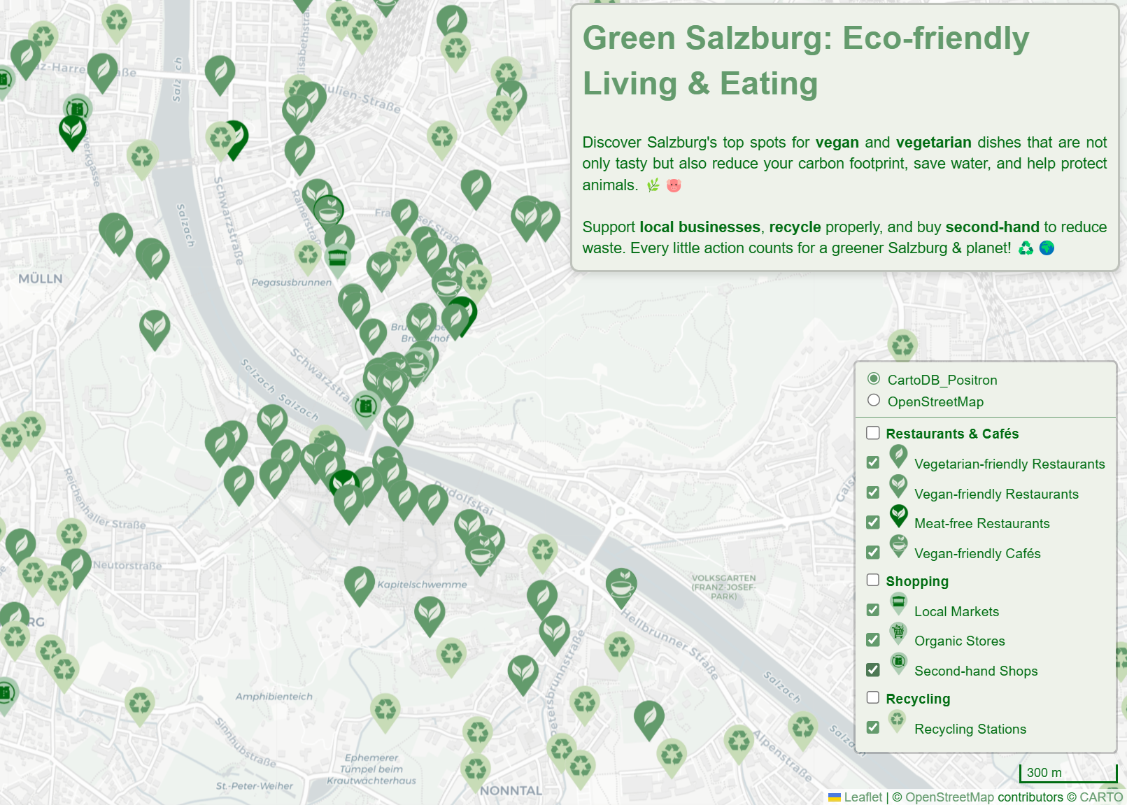
Green Salzburg: Eco-friendly Living & Eating
Geovisualization & Advanced Cartography
This web map created with Leaflet highlights restaurants and cafés with vegan or vegetarian options, opportunities for eco-friendly and sustainable shopping and recycling stations. The map thus contributes to a greener Salzburg by showing residents and tourists how they can reduce their carbon footprint, save water and recycle properly.
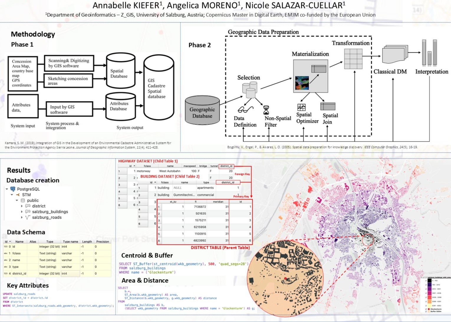
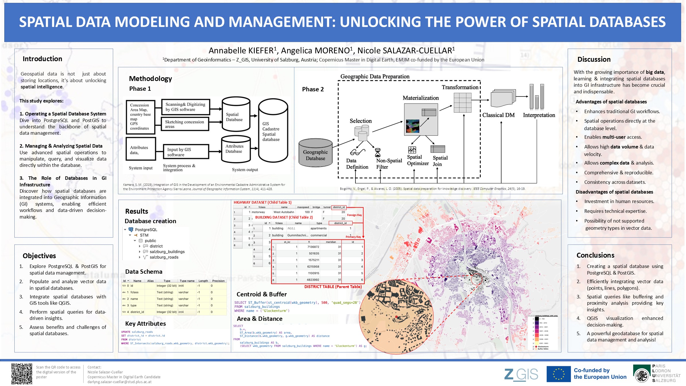
Spatial Data Modeling & Management
Spatial Thinking & Modelling
This scientific poster on spatial data modeling and management shows how to unlock the power of spatial databases. This poster is particularly helpful for interested users without prior knowledge, as it provides a general introduction to the topic. At the same time, the application of geodatabases is visualized using an example from Salzburg.
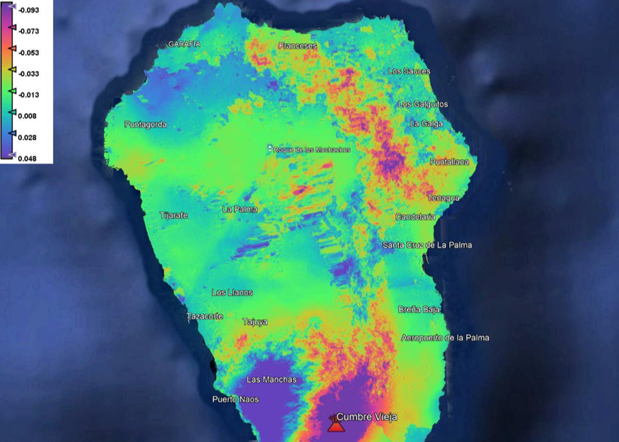
Displacement Map for Geohazard Assessment
Advanced Remote Sensing
This report describes the creation of a displacement map to detect the deformations after the volcanic eruption on La Palma in 2021. Sentinel-1 images were used as input and SNAP for the analysis. The methodology provides valuable insights for geohazard assessment and monitoring.
Compliance Mapping
Geohumanitarian Action
This StoryMap on Compliance Mapping deals with the importance of using Earth Observation and geospatial information tools to ensure efficient environmental compliance, especially in light of new regulations such as the European Deforestation Regulation (EUDR).
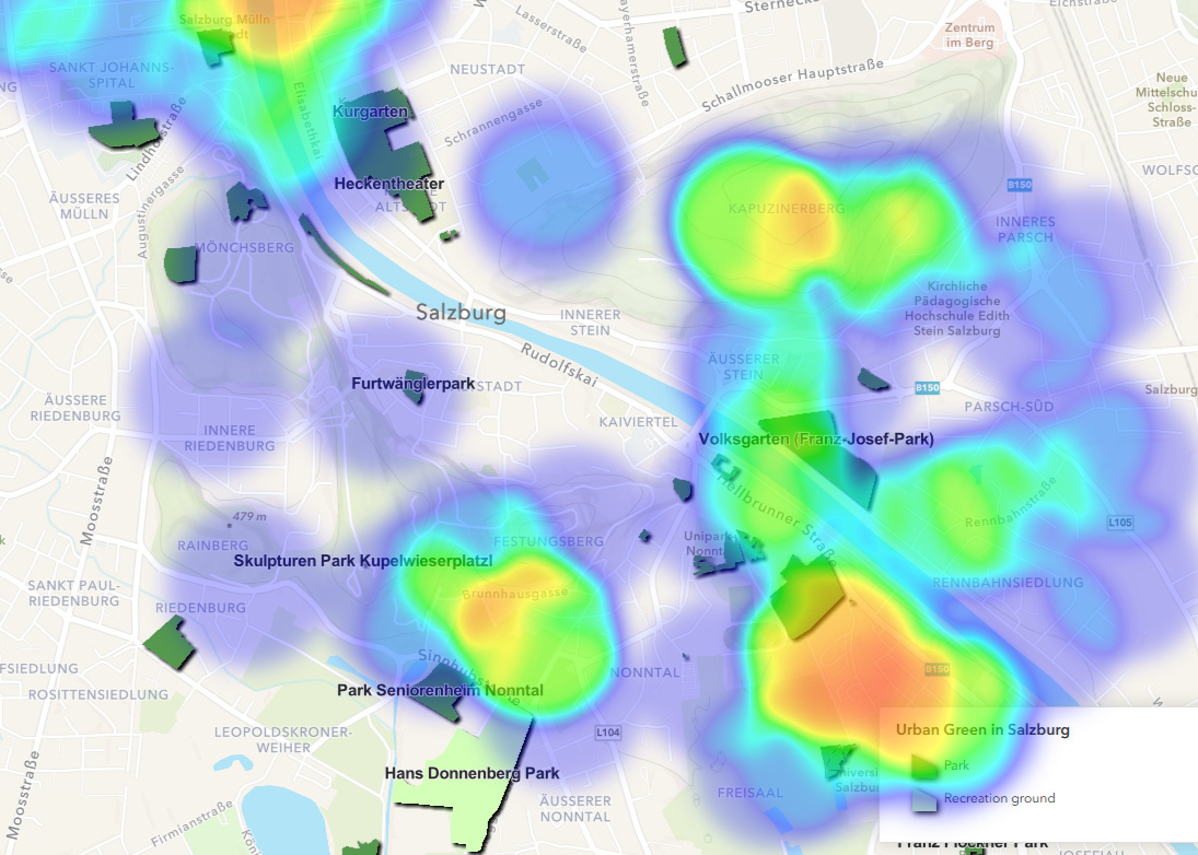
Eye Tracking Experiment
Geovisualization & Advanced Cartography
This eye-tracking study was conducted with Real Eye to test the effectiveness and user-friendliness of the cartographical output. In this context, a map of Salzburg with urban green spaces was presented to five participants.
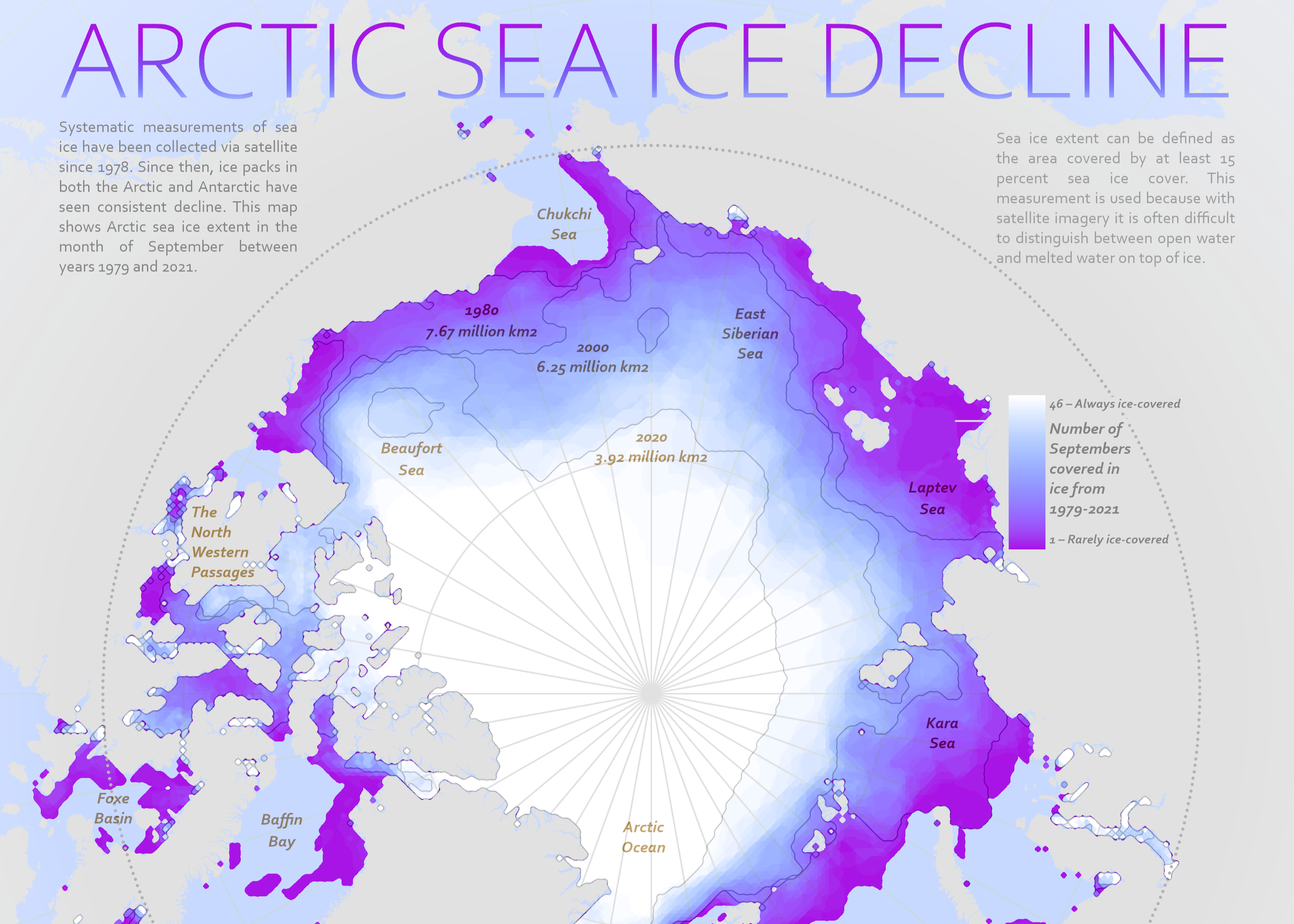
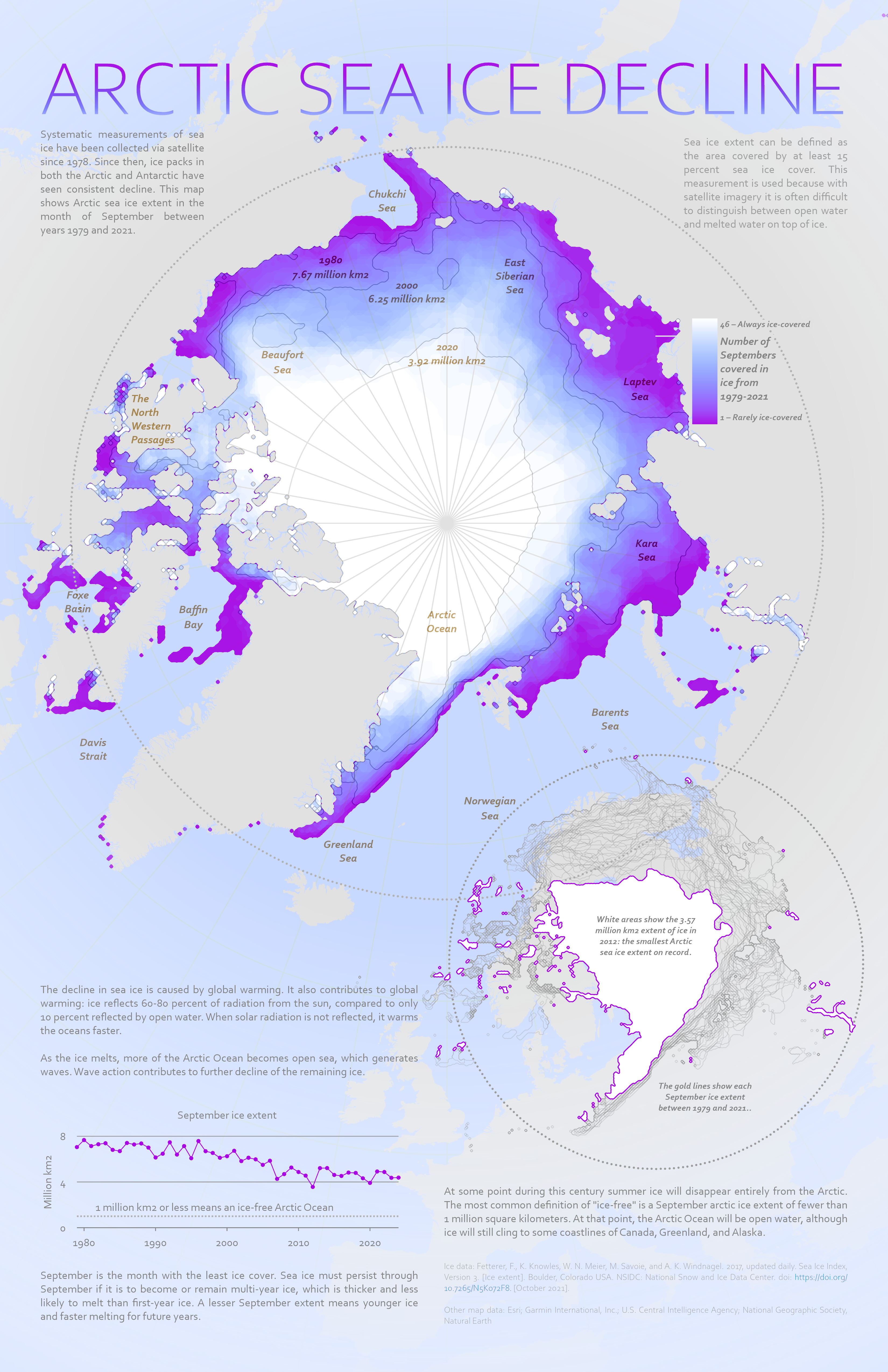
Arctic Sea Ice Decline
Geovisualization & Advanced Cartography
This map was created as part of an ESRI tutorial entitled Cartographic creations in ArcGIS Pro. In this context, I designed this map showing the Arctic Sea Ice Decline with a focus on an efficient symbology, labeling and layout technique.